On December 21st, the NSIDC reported a sea ice extent decline of 148,000 km2. Sea ice extent continues to set record lows with the possibility that we end the year at the lowest recorded for that date.

However this process of temporary heatwaves and storm induced compaction and perhaps, given the wave action, some ice melt, only helps reaffirm how weak this ice pack is compared to past decades.
To illustrate, we will track the Arctic changes prior to the storm and warmth till December 28, 2016. However, first here is an Arctic map to assist with location finding.

What follows mostly comes from the EOSDIS World View Sea Ice Concentration Layer interspersed with other charts by date to illustrate the drop, the heatwave and then the fast expansion of extent and concentration changes since the strongest storm passed on the 23rd.
December 1, 2016
Beginning with December 1, 2016, below, we observe the Franz Joseph Islands nearly surrounded by sea ice as the pack continues to expand. Areas of the Kara Sea remain ice free due to ocean warmth slowing refreeze.

To illustrate that sea surface temperature anomaly slowing refreeze here is the NOAA EMC SSTA for December 1st:

Source: http://polar.ncep.noaa.gov/sst/ophi/archive/20161201/color_anomaly_NPS_ophi0.png
December 14, 2016
The image below for the 14th reveals the sea ice extent and concentration just before a series of storms and wind change that reversed the winter expansion on the Atlantic side. The concentration anomaly in the Central Arctic Basin remains though somewhat diminished.

The imagery for the 22nd reveals the impact of the winter storm, wave action, and strong winds impacting the sea ice. The pact around Franz Joseph Land has been shredded, and north of Svalbard concentration has dropped.

The wind and temperature impacts for the 22nd are apparent in the earthnullschool imagery. The low passing west of Svalbard pulled the warmer air flowing from the south into the Central Arctic Basin, and that combined with the winds exceeding 50 mph swirled over the pack from northern Russia.

December 23, 2016
The strong low pulled the mid-latitude air over the Pole, with temperature anomalies that were 20-30 C above normal, a couple of brief hours hovering at 32 F.

December 24, 2016
Christmas Eve revealed the furthest retreat of the sea ice edge and obliteration of ice around Franz Joseph Land, with the additional weakening of the sea ice inside the pack appearing as yellow areas with about 75% ice. The storm, wind and wave impacts were ending, and with that, refreeze would begin rapidly.

December 28, 2016
During the last four days, much of the extent lost has been recovered - but with thinner ice that will continue to suffer the effects of wind, warmth and waves. Concentration in the Central Arctic is still ragged, with a pack on the move through the Fram Strait being impacted by current and future wind and storm. First, here the EOSDIS sea ice concentration for the 28th.

Here is the Magic Seaweed forecast for waves and storm impacts for today as of 1800 hours, Areas in yellow and orange represent wave heights over 20 feet.

Source: magicseaweed.com
Warmth still streams north along with this storm, here is a more local view first, then the "conveyor belt" of air flows that keep pummeling the Arctic over the next several days with moisture and warmth from the mid-latitudes. Areas in green and yellows are above freezing. Blue and fucia/purple are below freezing.


Finally, here is the wave forecast for January 1, 2017, which conveys that what we have witnessed as warm stormy conditions impacting Arctic sea ice will likely continue into January. The light blue and aqua still represent wave heights of 10-18 feet.

As Mats Granskog, a sea-ice researcher at the Norwegian Polar Institute in Tromsø and chief scientist of the Norwegian Young Sea Ice (N-ICE2015) project, presented at the AGU conference, there were...
“Lot’s of surprises. We saw a new Arctic where the ice is much thinner, only three to four feet thick and this ice functions much differently than it did five to ten years ago when the ice was much thicker.”
“We were also surprised that there was so much snow on the ice. Way more than we expected from earlier work."
“We observed the first northern most under sea ice phytoplankton bloom very early in the season when the ice was still snow covered. It was only this new Arctic ice, very mobile ice, that allowed this to happen."
"So we can say that this thinner and younger ice today works very differently than the ice we knew. It moves much faster. It breaks up more easily. It is way more vulnerable to storms and winds."
“The so called Arctic Amplification, the rapid warming of the Arctic, is in part caused by a reduction in the Arctic sea ice, seen in the last decade. And this has already impacted the patterns of weather and climate on the planet.”
"It is disturbing that the accelerated warming in the Arctic actually feeds more warming in the Arctic, and can even result in more drastic changes. And these drastic changes in the Arctic sea kind of calls into the question the knowledge that we have today about Arctic sea ice.”
To visualize his description, here is a glimpse of the current ice conditions, note the leads through the Central Arctic basin.
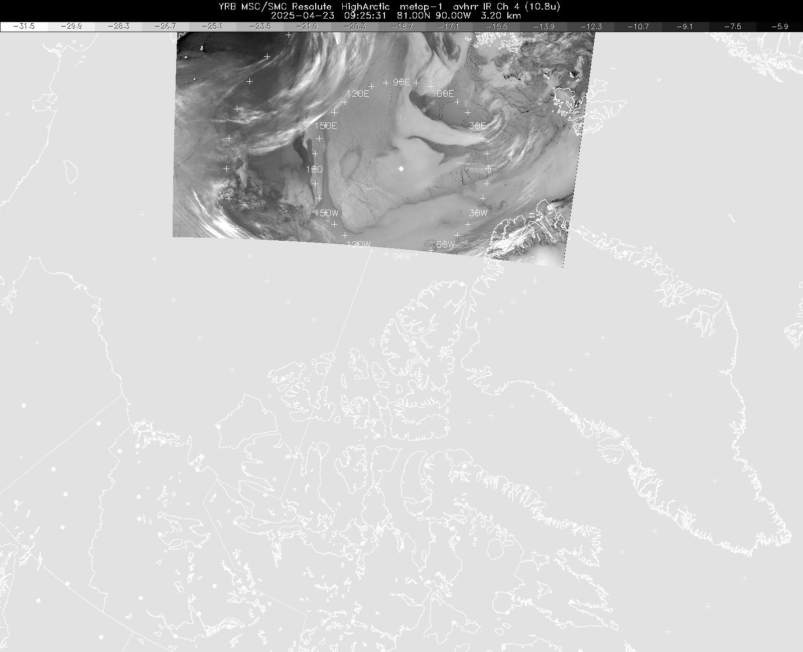
Finally a closeup glimpse of the Nares Strait, and fracturing through the older sea ice in the Canadian Arctic.
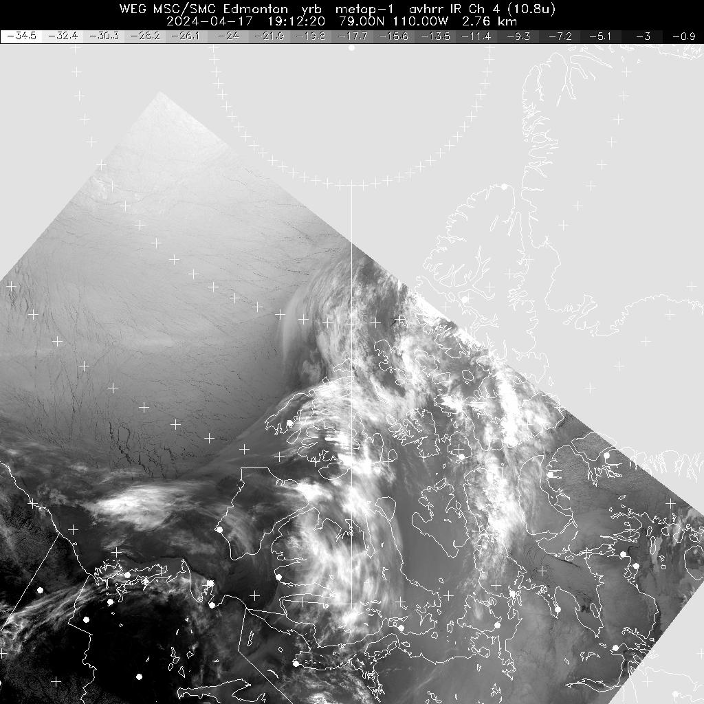
Source: Environment Canada
No comments:
Post a Comment